Trassey Track
Not a summit, a way in. An old mountain track running south-west from the Trassey Road along the northern flank of the Mournes, climbing steadily for six kilometres into the empty middle of the range. You turn round when you have had enough, and that is the point of it.
The distances are one way. This is an out and back with no loop and no summit, so the honest planning figure is the 12.5 km, and the honest expectation is that most people turn round well before the end.
This one goes properly into the mountains and the signal goes with it. Save a copy before you leave, and take the paper map as well; on this walk that is not a formality.
A walk with no destination, on purpose
Every other walk in this guide has something at the end of it: a summit, a stone, a harbour. This one does not. The Trassey Track is an old right of way that runs into the mountains and keeps going, and the mapped route simply stops after six and a bit kilometres at the highest ground it reaches. There is no cairn there and no view laid on.
What it gives you instead is the inside of the range. Within twenty minutes of the car the road noise is gone and you are walking a broad stony track along the northern flank with the high summits stacked up on your left, gaining height so gradually that you barely notice you have climbed 280 metres. It is the walk that makes the Mournes feel big rather than pretty.
Treat the full distance as an upper limit, not a target. Walk in for an hour, have your lunch looking at the mountains, and walk out. Nobody is checking.
Decide your turnaround time before you set off, and keep it. The track is so gentle that it will take you further in than you meant to go, and the walk back is exactly as long as the walk out.
Six kilometres in, and the same back
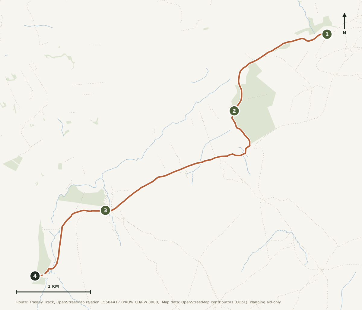
South-west from the Trassey Road on a broad stony track, climbing steadily along the northern side of the range. There is no junction to get wrong and no summit to reach; the walk is the walk.
Distances are one way from the road. Turn round at any point below and halve nothing: whatever you have walked in, you have that again to walk out.
Off the road
From the Trassey Road the track lifts away from the farmland and swings south-west. The first two kilometres are the tamest part of the day, rising about eighty metres on a good surface. This is where you find out what the wind is doing, because from here on there is nothing to shelter behind.
Into the range
The middle three kilometres are the reason to come. The track keeps its steady angle, the last of the farmland drops behind, and the high ground closes in on your left. You gain another ninety metres in here without ever feeling like you are climbing. For most people this is far enough: find a stone out of the wind, eat something, and be content.
Where the map runs out
The last stretch climbs a little more sharply to the highest ground the mapped route reaches, 336 metres, and then the mapped route ends. Not at a summit, not at a col, not at anything you could photograph. Paths carry on from here deeper into the range for people who know them; for the purposes of this page, this is the turnaround.
Being straight about it: this end point is where the official right of way as mapped stops, not a landmark. If you are not confident with a map and compass, treat the middle of the walk as your limit and turn back there.
The route on the map
Open the printable route map →The Trassey Track as mapped in OpenStreetMap, 6.3 km from the Trassey Road to the end of the mapped right of way. Use the layer control for terrain and contours, and note how much emptier the map gets the further in you go.
The climb, in profile
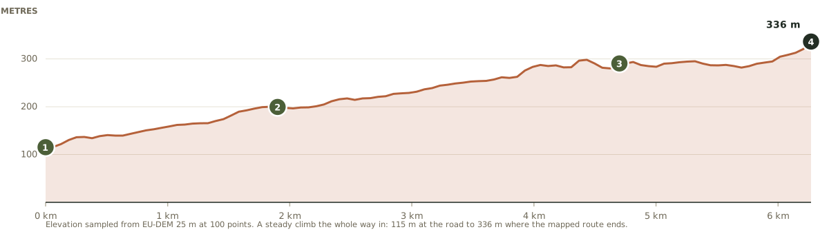
No shaded climb section on this one because there is nothing to shade: the whole walk is the climb. It goes up almost the entire way, which is why it never feels like hard work and why the return leg is faster than you expect.
Round to the far side
This is the only walk in the guide on the northern side of the mountains, so it is the longest drive: up the coast through Newcastle, then west on the Bryansford road and round to the Trassey Road. Allow about forty minutes from the house.
Parking
Roadside at the track entrance on the Trassey Road. It is limited and it is genuinely a country road, so park considerately, do not block the gate, and if it is full go and do something else rather than invent a space.
Facilities
None whatsoever. No toilets, no cafe, no bin. Newcastle is the nearest of any of it, twenty minutes back down the road.
Dogs and livestock
This is working hill farm ground. Dogs on leads the whole way, and close every gate you open.
Coordinates rather than a postcode: this is a rural road and postcodes cover a wide area here.
Pack for the mountains, not the track
Always
Boots. The surface is stony and uneven for most of its length.
Proper windproofs. Nothing on this track breaks the weather, and you are exposed from about two kilometres in.
Map and compass, and the ability to use them. Sheet 29 lives in the hall cupboard at the house.
More food and water than a six kilometre walk sounds like it needs. There is nothing out there.
Worth it
A flask. This is a sit-down-and-look-at-it walk more than a get-there walk.
Binoculars, for the summits stacked up on the left the whole way in.
A watch, and a turnaround time you agree before you start.
An easy track in a serious place
The walking here is easy. The setting is not. This track takes you further from a road than anything else in this guide, and the gentle gradient is exactly what makes people overcommit.
Fix a turnaround time and keep it. The track is so easy that you will walk further in than you meant to, and everything you walked in you must walk back out, usually into the wind.
Do not improvise a route onward. Paths continue from the end of the mapped track deeper into the range. They are for people with the navigation to match. If that is not you, turn round.
Cloud changes this walk completely. On a clear day it is unmistakable. In low cloud a broad featureless track through open ground is a much harder thing to follow than it sounds.
In an emergency: dial 999 or 112, ask for Police, then Mountain Rescue. Mourne Mountain Rescue Team are volunteers and cover this ground. Tell someone your plan before you set off on this one.
A right of way, not a leisure path
The Trassey Track is a recorded public right of way, carried on the council's register as CD/RW.8000. That is a small detail with a large meaning: this is not a path somebody laid out for visitors, it is a route that existed because people needed to move stone, stock and themselves through these mountains, and which has been protected because it was already there.
It reads that way underfoot. No steps, no boardwalk, no interpretation boards, no attempt to make it comfortable. Of everything in this guide it is the walk that feels least designed, which is exactly why some people will prefer it to all the others.
The long way home
Forty minutes back around the range, which after a day in the open is not the worst thing: you get the whole northern side of the Mournes out of the window on the way, and by the time you reach the coast road you will have stopped talking. Then a hot shower, somewhere to hang everything, and the hot tub, which after this one you will have earned twice over.
Route line and distances derived from the Trassey Track as mapped in OpenStreetMap (relation 15504417, operated by Newry, Mourne and Down District Council, public right of way CD/RW.8000), measured at 6.3 km one way. Heights sampled from a 25 m elevation model. The route as published here ends where the mapped right of way ends, which is not a landmark and is stated as such above rather than dressed up as a destination.
High Mourne House is a demonstration property. The track, the right of way and the safety advice are real; the house is not.
Walk in as far as you like. We will still be here.
Check your dates and make High Mourne House your base for the Mournes.
Check availabilityIf you want somewhere to get to
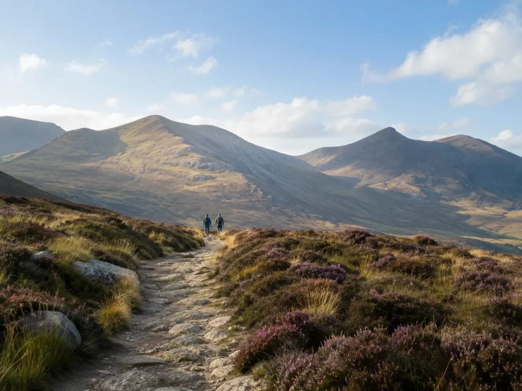
Slieve Donard
A summit at the end of it, and the highest one in Northern Ireland.
Read the full route guide →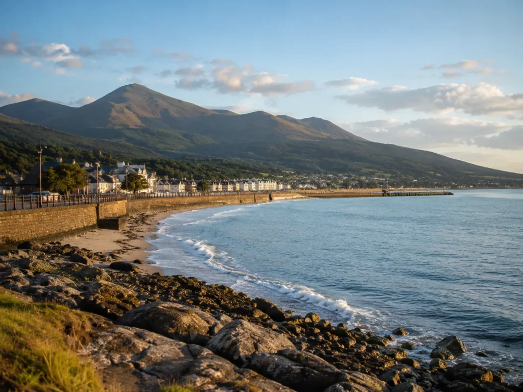
Annalong Coastal Path
The opposite of this one: short, flat, and starting at the front door.
Read the full route guide →