Donard Forest Loop
Donard without the mountain. A four and a half kilometre forest loop above Newcastle, climbing to the old millstone workings on the shoulder of Thomas's Mountain, with the bay opening up behind you and none of the commitment of the summit.
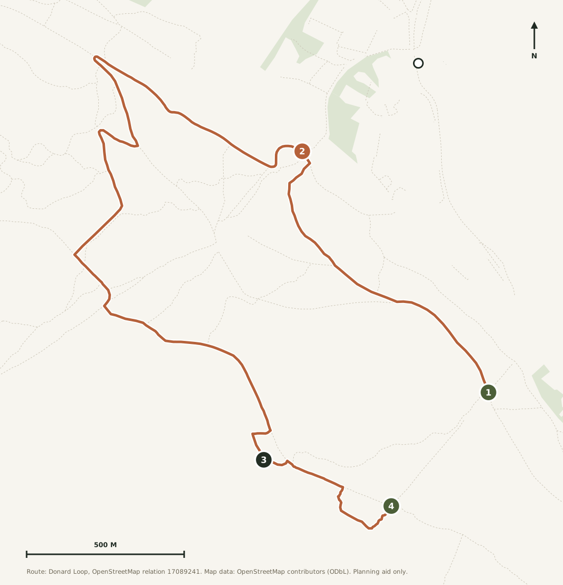
Two things the raw figures hide. The mapped loop sits up in the forest, so from Donard Park you add roughly a kilometre at each end to reach it and get back. And its two ends stop about 500 metres apart, which you close along the forest road.
Forest tracks all look alike once you are among the trees, and the junctions are the one place people go wrong on this walk. Worth having the map in your pocket.
The walk for the day the tops are in cloud
This starts from the same car park as Slieve Donard and shares its first stretch of forest, then turns away and stays among the trees. It climbs a genuine 256 metres, so it is not a stroll, but it is all on forest track and none of it is exposed. When the summits are wrapped in cloud and the mountain would give you nothing, this gives you a proper walk anyway.
It also suits a group that cannot agree. Anyone who wants the big day out can go up Donard from the same spot; everyone else can do this and be back in Newcastle for lunch. The reward at the top end is the old millstone workings and a view down over the bay that most people who drive to Newcastle never see.
If Donard Park is full, this is the walk to switch to. Same car park, half the commitment, and you will still have earned your lunch.
The route, stage by stage
Up from Donard Park into the forest to join the loop, then a long steady climb on forest track to the millstone workings on the shoulder of Thomas's Mountain, and back down through the trees.
Distances below are along the mapped loop itself. Add roughly a kilometre at each end for the walk up from Donard Park and back. The profile shows the shape: a drop toward the river first, then one long climb of nearly three kilometres to the high point at 3.9 km.
Into the trees
Leave Donard Park by the same corner as the Slieve Donard path and climb into the forest. You share the route with everyone heading for the summit at first, then the tracks divide and the crowd goes one way while you go the other. After about a kilometre you are on the loop proper, dropping gently toward the river before any of the real work starts.
The long climb
This is where the 256 metres happens, and it happens over nearly three kilometres. From the low point by the river the track turns uphill and simply keeps going, in long forestry zig-zags with occasional gaps in the trees where the bay appears below you. It is never steep enough to stop you, but it does not let up either. Take the gaps in the trees as an excuse to turn round and look.
The quarries, and down
The high point comes at about 3.9 km, near the old millstone workings on the shoulder of Thomas's Mountain. From there the loop swings back and drops quickly through the forest to finish, about 500 metres from where it began.
Closing the loop: the mapped route begins and ends about 500 metres apart in the forest. Both points sit on the same forest road above Donard Park, so joining them is obvious on the ground even though the map shows a gap.
The route on the map
Open the printable route map →The waymarked Donard Loop as mapped in OpenStreetMap, 4.5 km of forest track from Donard Park. Use the layer control for terrain and contours.
The climb, in profile
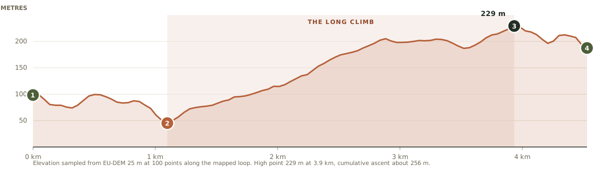
The shaded band is the long climb, from the low point by the river at 1.1 km to the high point at 3.9 km. Note the dip at the start: the route loses height before it gains any.
The same car park as Donard
Fifteen minutes from the house: the coast road north through Annalong into Newcastle, then the one-way system to the south end of the main street. Donard Park is signed from there.
Parking
Free, with a large main car park and an overflow area. It fills early on good summer days because everyone climbing Donard uses it too, which is one more reason to do this walk when the tops are in cloud.
Facilities
Public toilets with baby-changing, accessible bays and EV charging points, and Newcastle itself is a ten-minute walk away.
By bus
Ulsterbus service 37 runs the coast road from Annalong to Newcastle Bus Station roughly hourly; Donard Park is about ten minutes on foot from there. Check Translink for times.
Postcodes for this car park vary between sources; use the coordinates or the grid reference.
Forest, not mountain, but still a climb
Nothing here is exposed and you are never far from Newcastle, but this is still 256 metres of ascent on rough forest track. Three things worth knowing.
The junctions are the hard part. Forest tracks branch often and look identical under the trees. This is the one walk in the guide where having the map on your phone genuinely earns its place.
Forestry work happens. Tracks are occasionally closed or diverted for felling. Signs on the ground beat anything printed here or on a map.
It gets dark early under the trees. A good half hour before it does out on the open hill. Set off with enough of the afternoon left, or carry a torch.
They cut millstones up here
The high point of the walk runs out near old workings on the shoulder of Thomas's Mountain, where Mourne granite was quarried and dressed. This coast ran on stone for well over a century: quarried on the mountain, brought down to the harbours, and shipped out to pave and kerb cities across the water. Newcastle and Annalong both exist in the shape they do because of it.
What is left is scattered and overgrown rather than presented, which is part of the appeal. Nothing is fenced or explained. You are simply walking through the leftovers of an industry that shaped the whole coastline below you.
Home by mid-afternoon
That is the quiet advantage of this one. Chips on the promenade if you want them, then fifteen minutes back down the coast with most of the day still in front of you. It is the walk that leaves you time to do something else.
Route line derived from the Donard Loop as mapped in OpenStreetMap (relation 17089241, operated by Newry, Mourne and Down District Council), measured at 4.5 km. Ascent sampled from a 25 m elevation model. The mapped loop begins and ends inside the forest, roughly a kilometre from Donard Park, and its two ends stop about 500 metres apart; both are noted above rather than smoothed over.
High Mourne House is a demonstration property. The forest, the quarries and the route are real; the house is not.
A walk for every kind of weather.
Check your dates and make High Mourne House your base for the Mournes.
Check availabilityFrom the same car park
Slieve Donard
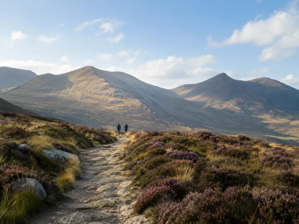
Same car park, the full commitment. The highest point in Northern Ireland by the Glen River.
Read the full route guide →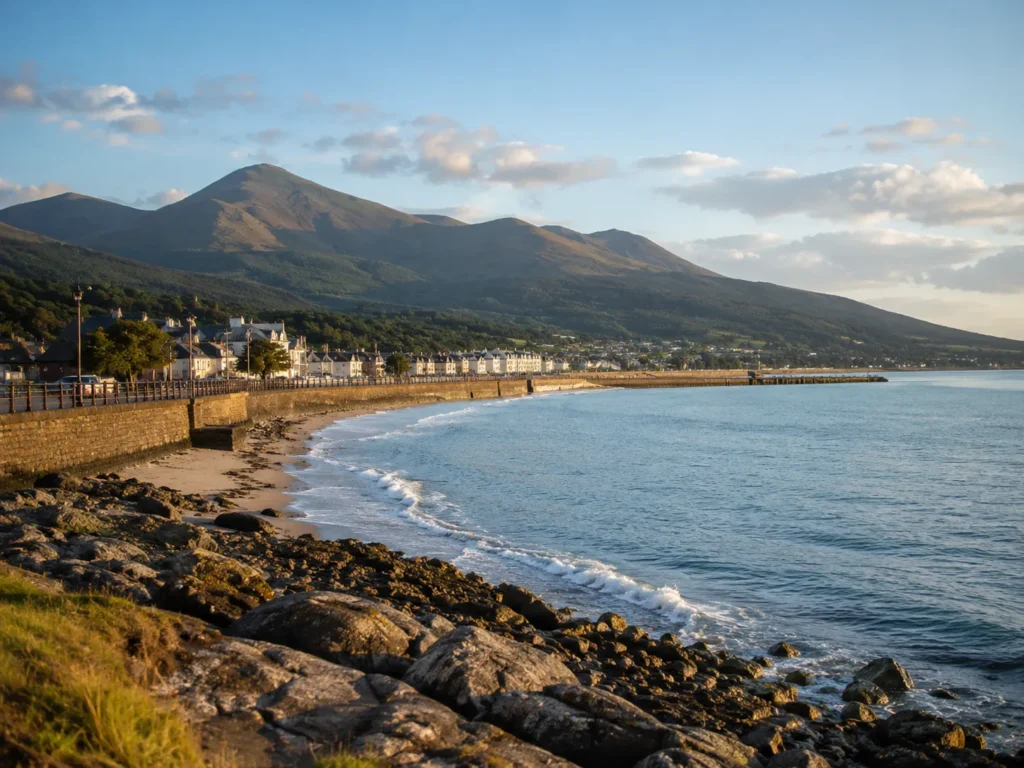
Annalong Coastal Path
Flat shore path past the harbour, and no car needed at all.
Read the full route guide →