Slieve Donard
The highest point in Northern Ireland, and the walk guests ask us about most. Around nine and a half kilometres there and back, most of it uphill, with a granite wall to follow and the Irish Sea at your back the whole way down.
Officially listed as 2.9 miles - that's one way. Plan for the round trip.
Signal disappears above the treeline. Save a copy before you leave the house and you'll still have the route, the parking and the emergency number when your phone gives up.
Everyone wants to do Donard.
It is a hard walk, and we won't pretend otherwise - you climb the best part of 830 metres in one go, with nothing much in the way of flat ground to get your breath back. But it isn't a technical mountain: there's no scrambling, no exposure, and the path is clear and largely flagged the whole way to the top. It is a straightforward route for reasonably fit, properly equipped walkers in good conditions, but it remains a sustained mountain day, and weather and visibility can change quickly. It asks for legs and patience rather than skill.
What makes it worth the effort isn't only the summit. The walk changes character four or five times on the way up - deep oak and pine woodland, then a wide-open valley, then a steep granite staircase against the skyline - so it never settles into a slog. And the view from the top, on the one day in four when you get one, takes in the Isle of Man, the Wicklow hills, and sometimes the Welsh coast.
Start early. The car park fills by mid-morning on a good summer weekend, and the mountain is a better place at nine than at one.
The route, stage by stage
Out and back on the same path, following the Glen River up to the col between Donard and Commedagh, then left along the Mourne Wall to the summit.
Distances on each stage are one way, measured from the car park. Double them for the round trip.
Through the trees
From the top corner of Donard Park car park, head towards the mountain and pick up the Glen River, climbing through old woodland of Scots pine, oak and birch. This first section is steeper than people expect and catches out anyone who set off too fast.
You'll cross three bridges. Take the first one over to the far bank, and after roughly 400 metres - along a stretch where the ground overhangs a deep-cut riverbed, so keep children and dogs close - cross back at the second. The third brings you out onto a forest road.
There are pools along here worth remembering for the way down, when your legs are finished and the water suddenly seems like a good idea.
The open valley
Past the old ice house the trees fall away and the walk changes completely. Cross the forest road onto the rough track, follow it up past a gate and stile, and you're into a long, broad, open valley with the river on your left and the two summits ahead.
This is the easiest two kilometres of the day and the best place to settle into a rhythm. Look back for the first proper view of Newcastle and the bay.
The pull to the Saddle
The path crosses the river and swings uphill in a steady curve toward the col - the Saddle - between Slieve Donard on your left and Slieve Commedagh on your right. It's short, it's steep, and it delivers you to the Mourne Wall with the whole southern half of the range suddenly laid out in front of you.
Most people stop here for a sandwich. It's the natural halfway point in effort, if not in distance.
The wall
Turn left and follow the wall. This is the hardest part of the day: a relentless granite staircase, straight up, no switchbacks, no mercy. It's a little under 300 metres of climbing and it will take longer than you think.
The trick is not to look up. Pick the next twenty metres of wall and deal with that.
The top
The summit arrives suddenly. There's a stone tower where the walls meet, dated 1910, and a large cairn sitting slightly apart on its plinth.
The top is broad and rounded, so walk to the edges for the views - north for the best one, straight down over Newcastle, the beach and the whole sweep of Dundrum Bay.
Coming down: return the way you came. Stay close to the wall until you're back at the Saddle. Do not be tempted north-east toward the cliffs above Newcastle - those are Eagle Rocks, the approaches are steep and loose, and people get into trouble there.
The route on the map
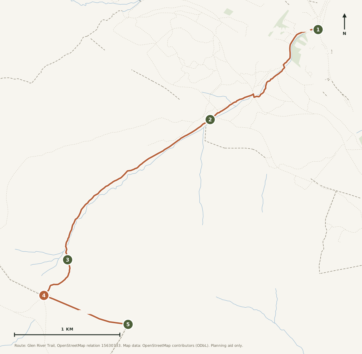 Open the printable route map →
Trail shown is the waymarked Glen River Trail as mapped in OpenStreetMap, 4.9 km each way from the car park to the summit. Use the layer control for terrain and contours. A phone map is not a substitute for OSNI Sheet 29 and a compass.
The climb, in profile
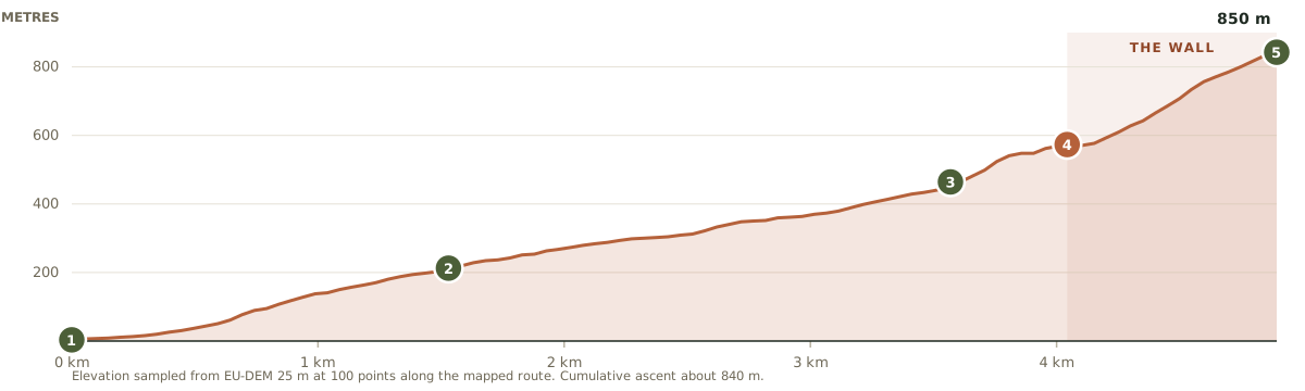
Sea level to 850 metres in under five kilometres, with almost no flat ground. The shaded section is the wall: a little under 300 metres of climbing in the last 850 metres of walking, which is where most people find out what the day is really made of.
Fifteen minutes from the house
Follow the coast road north through Annalong into Newcastle, then the one-way system to the south end of the main street. Donard Park is signed from there.
Parking
Free, with a large main car park and an overflow area for busy days.
Grid reference
J375305.
Facilities
Public toilets with baby-changing, accessible bays and EV charging points.
Dogs
Welcome, but on leads - this is working sheep country as well as a national park.
Public transport
Ulsterbus service 37 runs the coast road between Kilkeel and Newcastle roughly hourly, stopping on Annalong Main Street near the house and at Bloody Bridge. Stay on to Newcastle Bus Station; Donard Park is about a ten-minute walk from there. The whole Kilkeel to Newcastle run takes around 35 minutes. Check Translink for current times.
Postcodes for this car park vary between sources, so use the coordinates or the grid reference rather than a postcode. The walk starts from the top corner of the car park, furthest from the sea.
What to take
Always
Proper boots with ankle support. The flagged sections are slick in the wet.
More layers than the car park temperature suggests. It is routinely ten degrees colder and considerably windier at the top.
Waterproofs, even on a clear morning.
Two litres of water and more food than you think you need.
A paper map and the knowledge to use it - Sheet 29 lives in the hall cupboard at the house, and you're welcome to borrow it.
Worth it
Walking poles, mostly for the descent.
Sun cream - there is no shade above the treeline.
A swimming costume, for the river pools on the way back down.
Something warm and dry left in the car for afterwards.
A friendly mountain in good weather. A serious one in bad.
Donard is a friendly mountain in good conditions and a genuinely serious one in bad. The weather here turns faster than almost anywhere else in Ireland, and cloud can drop onto the summit in twenty minutes.
Check the forecast the morning of, not the night before. If the tops are in cloud, the summit gives you nothing but a cold wall and a longer walk. The Donard Forest Loop leaves from the same car park and stays below it.
Tell someone your plan - including us, if you like - and roughly when you expect to be back.
Turning round is not failing. The mountain will be there next time.
Avoid Eagle Rocks, the cliffs on the north side of the summit. Steep, loose, and the single most common way people get into difficulty here.
In an emergency: dial 999 or 112, ask for Police, then Mountain Rescue. Mourne Mountain Rescue Team are volunteers, on call every day of the year, and they have been since 1962.
That wall took eighteen years
The Mourne Wall isn't a field boundary and it isn't decorative. It was built between 1904 and 1922 by the Belfast Water Commissioners to enclose the catchment that feeds the Silent Valley reservoir - twenty-two miles of dry stone running over fifteen summits, roughly head height, laid by hand across ground that will make your legs ache just walking beside it.
The tower at the top of Donard is dated 1910. There are two others, on Commedagh and Meelmore, and once a year the truly committed attempt the whole circuit in a day.
It's worth a moment at the summit to think about men carrying stone up the slope you have just climbed empty-handed.
People have been coming up here a very long time
The mound near the summit is a prehistoric burial cairn - it has been on top of this mountain for thousands of years, which puts a four-hour walk into some perspective. The mountain takes its name from Domhanghart, a fifth-century saint said to have kept a hermitage on the summit, and pilgrims climbed it every year well into the modern era.
A gentler note: a wildfire in April 2021 burned across Donard, Thomas's Mountain and the Glen River valley, and the recovery is still going on. You'll see the scars. Stay on the path, take everything home with you, and don't light anything.
The bit afterwards
Chips on Newcastle promenade on the way home is practically obligatory, and nobody will judge you for eating them in the car.
Then it's fifteen minutes back down the coast to a hot shower, somewhere warm to hang everything that got soaked, and a hot tub that will make more sense to you at six o'clock this evening than it ever has before.
Route information adapted from the published listing at WalkNI, maintained by Outdoor Recreation Northern Ireland, with distances and timings adjusted to reflect the full round trip. Conditions on the hill change - treat this page as a starting point, not a substitute for a map, a forecast and your own judgement.
View the source route on WalkNI →High Mourne House is a demonstration property. The route, the mountain and the safety advice are real; the house is not.
Climb it. Then don't move for a while.
Check your dates and make High Mourne House your base for the Mournes.
Check availabilityMore walks nearby
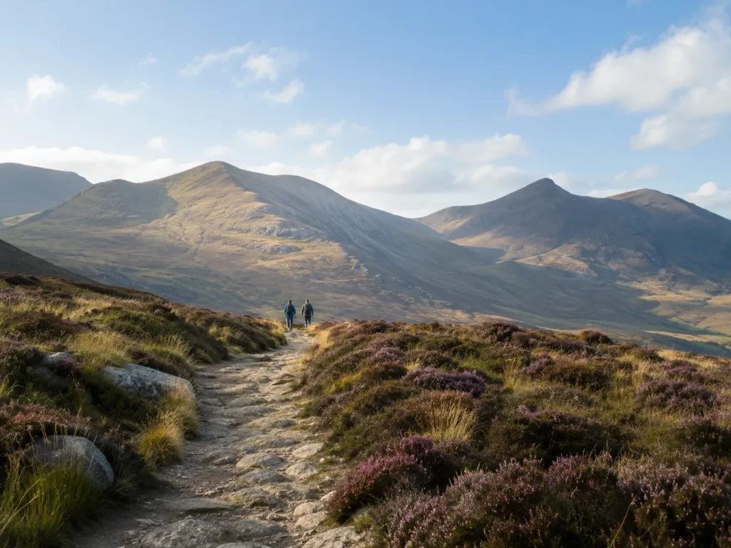
Donard Forest Loop
Same car park, half the commitment. Forest track to the old millstone quarries.
Read the full route guide →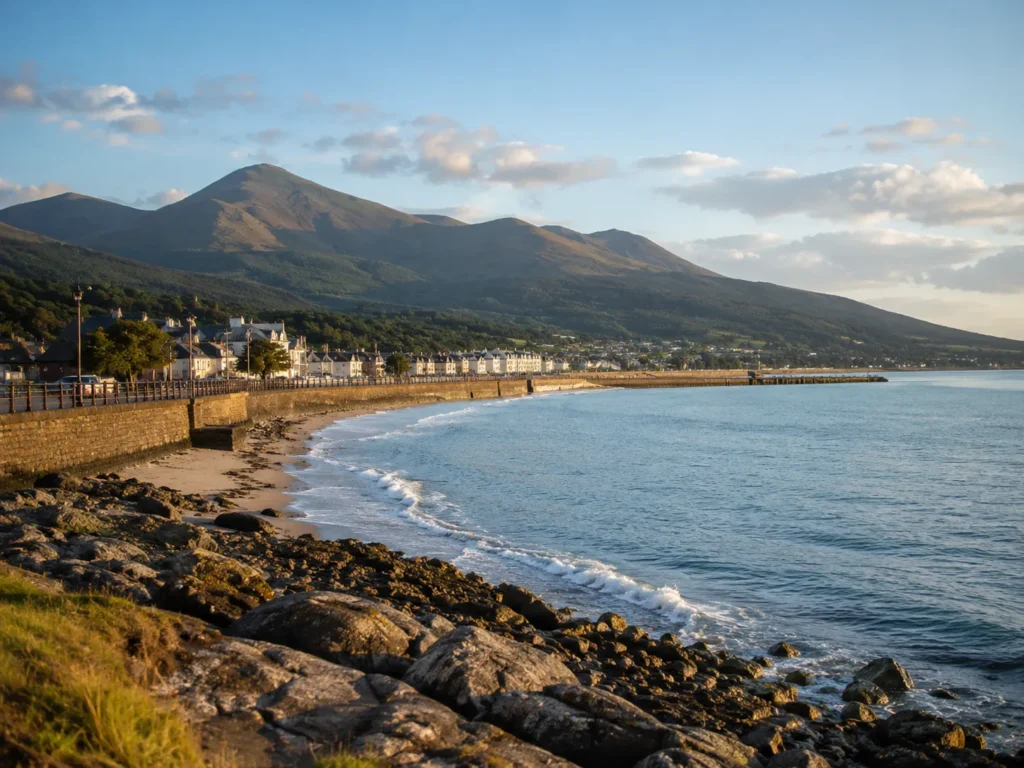
Annalong Coastal Path
Flat shore path past the harbour, and the only one you can start on foot.
Read the full route guide →Cloughmore & Rostrevor
A forty-tonne boulder above Carlingford Lough, and the biggest view for the least effort.
Read the full route guide →